
")
(Photo courtesy of Richie Bulda)
I was getting a bit concerned because the first half of the day was already over, yet we haven’t even explored the Pawikan Cave yet. Since it involved some mountain climbing, I thought there wouldn’t be enough enough daylight left to go trekking, spelunking and more island hopping later in the afternoon. But since Kuya Jingle, our pilot, didn’t seem to view this as a problem, I just trusted in his judgment and went with the itinerary.
PAWIKAN CAVE
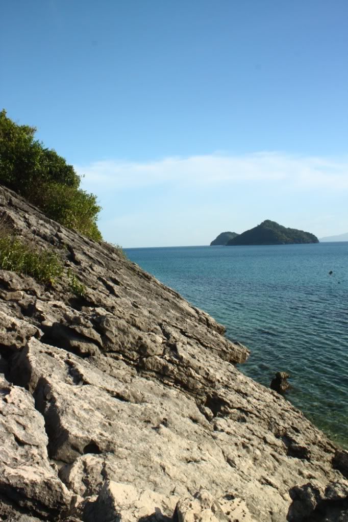
Like the Tangke Saltwater Lagoon, the Pawikan Cave is also located in the island of Gigantes Sur, so it was just a short boat ride going to another side of the island where a village near the cave is located. Upon arriving, we immediately set ourselves to the task of looking for a local whom we could hire as a guide. Since none of us spoke Ilonggo, Kuya Jingle’s assistance proved to be invaluable and we promptly started our trek once we were able to agree upon a guide fee with a lad.

I got this “scratch” on my left knee when it came in contact with the sharp rock. It scraped off a sliver of epidermis.
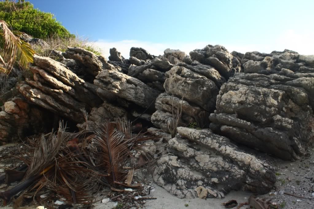
The 20- to 25-minute trek wasn’t too tiring because the slope of the trail wasn’t steep and was even horizontal on some stretches. However, one still has to be careful because the terrain is a combination of soil and sharp rock. One slip on the wrong surface would almost always result in scratches, cuts or, worse, gashes.

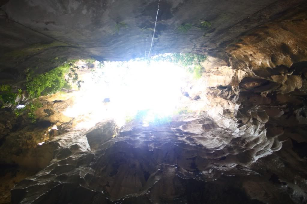
The entrance of Pawikan Cave, as seen from inside.
Before long, we found ourselves at the entrance of the cave. My first impression was one of extreme disappointment because there was graffiti everywhere in the entrance chamber. Worse, a lot of these seemed to be painted on the cave walls by mountaineering and other outdoor groups – the exact group of people who should not be doing this sort of thing. There was also a lot of trash – plastic food wrappers. This cave is desperately in need of a clean up.
Thankfully, all acts of vandalism are dramatically reduced once one enters the more cavernous inner areas of the cave. But one might still spot the occasional unsightly candy wrapper on the floor.
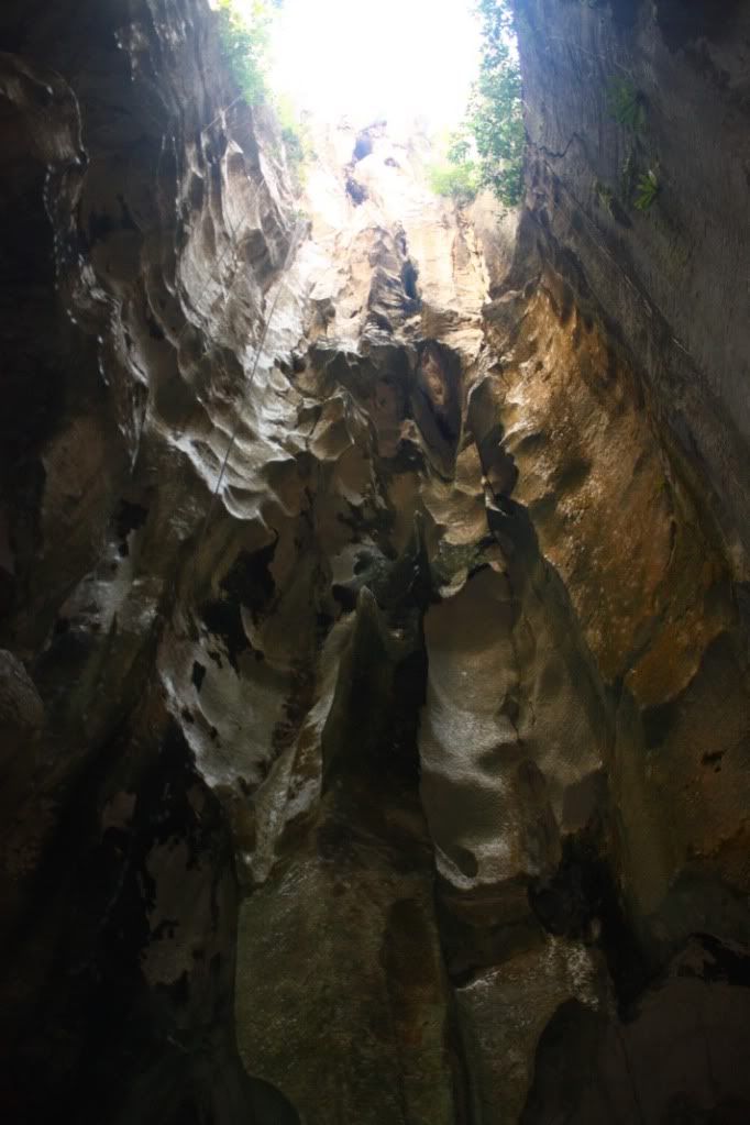
The Pawikan Cave is “roofless”. Where a ceiling should be in some parts, there are only gaping holes where sunlight freely enters and makes everything visible. But since the walls are a few stories high, sunlight never really directly penetrates the cave floor for most of the day. The result is that the cave is cool in daytime, well-ventilated, and one does not really need any source of light to explore it.
The disadvantage however is that in most parts, the cave can’t shelter anyone from the rain, but this is just a minor inconvenience because visits to the Gigantes are mostly done during the summer anyway.

We never got to ask why this was called the Pawikan Cave. It seems unusual a name given the fact that a pawikan (sea turtle) is neither a mountain nor a cave dweller. And besides, there wasn’t anything to be seen in the cave that remotely resembles a sea turtle. I’m guessing this was known by a different indigenous name before that sounded similar to pawikan, that eventually, throughout the years, it simply evolved into its present pronunciation.
Photographers would have a nice time taking pictures in here. The interplay between the changing angle of daylight and the chiseled rock formations on the cave walls ensure that no two pictures of the same spot will be the same.
")
(Photo courtesy of Gracey Isles)
At first, the three of us had a difficult time finding the right camera settings because we set our cameras for shots involving bright sunlight. Eventually, through a lot of trial and error, Gracey discovered that the crucial element was the white balance. She found that when she set it to “Cloudy”, the images had a slightly more reddish hue, which made the resulting photo more attractive. Richie and I then followed her lead and adjusted our own cameras’ white balance accordingly.
Although it was a large cave, it had little floor space. Meaning, it did not extend further inside the mountain. You can basically fit a medium-sized building in it, and that’s about all the cubic feet it has. No cave connection, no trails leading further inside the mountain. It’s just one big cavity that has a small side opening and some large openings at the top.
Pawikan Cave might seem to be an out-of-the-way destination for those who want to concentrate on island-hopping in the Gigantes, but I can assure everyone that this is one side trip that’s worth the effort.
")
Gracey admiring the size of the cave. (Photo courtesy of Gracey Isles)
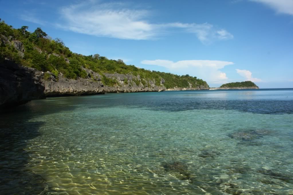
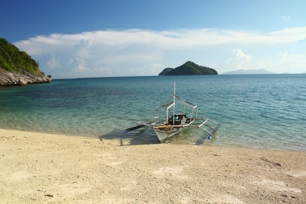
TINAGONG BAYBAY
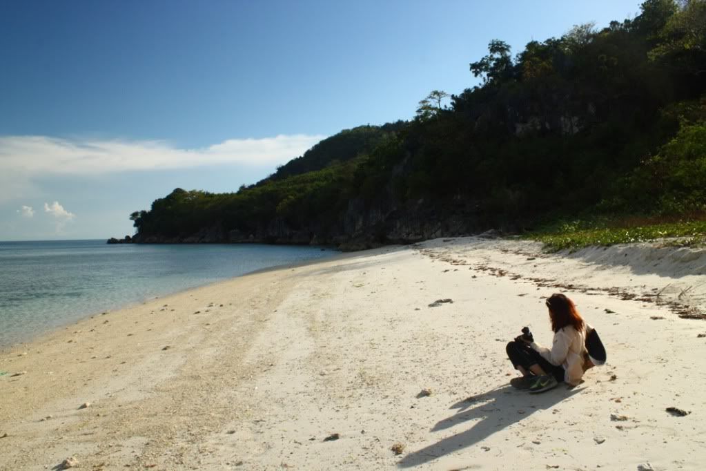
I’m not sure if Tinagong Baybay was really in our itinerary. What I remember was it was suggested to us by some teenagers we met at Tangke, and when we inquired about it with Kuya Jingle, he simply answered we will go there.
So after exiting he cave and descending the mountain, we got on the pumpboat and proceeded to yet another side of Gigantes Sur to get to Tinagong Baybay. Along the way, we passed by the entrance to Tangke. When we first caught sight of our destination, I remember thinking that its name is very appropriate. Tinagong baybay literally means “hidden seashore” and while it’s still exposed, it usually is bypassed in favor of the more visually appealing Antonia Beach nearby.
There are no man-made structures in Tinagong Baybay. It also has no access to the interior of the island because the small strip of white sand beach is surrounded on all sides by rocky cliffs and thick vegetation. It really just a place where one can drop by, hang out, and leave.
")
(Photo courtesy of Gracey Isles)
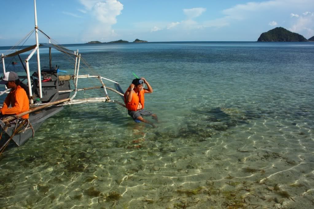
Each of us did our own thing while beach bumming here. Gracey was content in just staying put in one place and taking pictures of anything that catches her fancy. Richie wanted to maximize the fee he paid for the snorkel and diving mask rental so he went snorkeling again.
As for me, I decided to walk the entire length of the beach while eating an apple. I wanted to see what’s on the other end.
")
(Photo courtesy of Richie Bulda)
Finding nothing interesting there, I walked back, trying to look candid while Gracey was shooting me.
")
(Photo courtesy of Gracey Isles)
From Tinagong Baybay, one can actually already see Antonia Beach, which is our next destination. And since it was so near, there wasn’t any rush to leave right away. The sun’s heat was no longer unbearable as the hottest part of the afternoon was already passing.
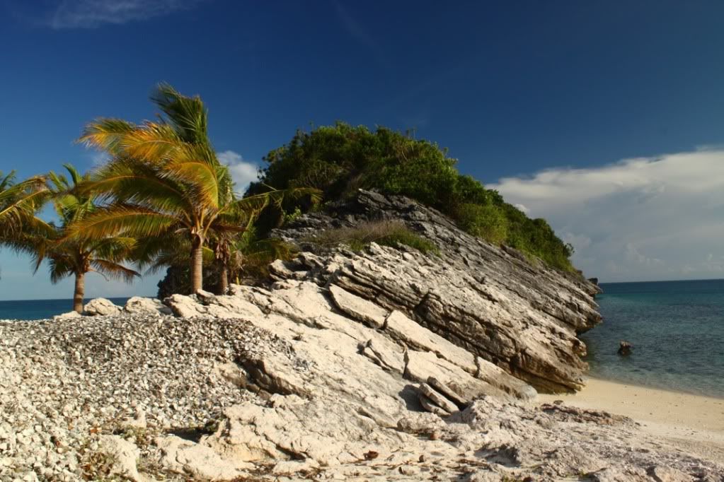
ANTONIA BEACH
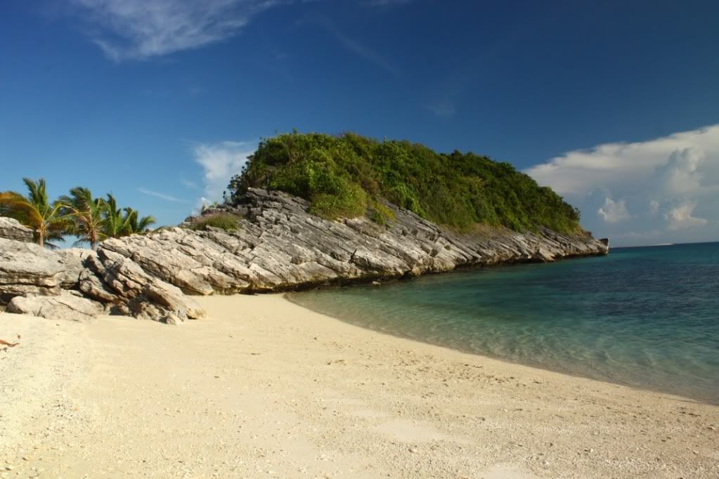
A few blogs that I’ve come across mislabel Antonia Beach as “Antonia Island”. Actually, it’s still part of Gigantes Sur, and definitely not a separate island, as it became apparent to us when we caught sight of it on the way to Tinagong Baybay. However, just like Tinagong Baybay, Antonia Beach is isolated from the interior of the island by an entire landmass of solid rock and thick vegetation.
")
(Photo courtesy of Gracey Isles)
Antonia Beach is a bit like Cabugao Gamay in the sense that it has a stretch of white sand beach that faces two directions; and the point extending to the sea is made up of rock formations that one can climb.
Speaking of the rock formation, it has a distinctive pattern that makes it look like a neatly toppled set of domino tiles when viewed from the sea. This is far easier to climb than that of Cabugao Gamay’s rock formation because here, it’s not as high and part of the formation was naturally sculpted to be like stairs.
An old married couple reside in Antonia Beach as caretakers. As our drinking water supply was running out, we were only too eager to purchase from them freshly picked young coconuts to quench our thirst. Aside from a beach house, there are some concrete structures that was constructed by the government for some forgotten reason.
")
(Photo courtesy of Gracey Isles)
According to the couple, some tourists occasionally go here in Antonia Beach to camp overnight and hold beach parties. And looking at this place, it really does seem like a nice place for camping. There’s still room for improvement though, in terms of garbage management, but this is a relatively minor thing that can easily be solved as it’s just a matter of moving stuff in another part of the beach that would be unseen.

A huge mound of discarded scallop shells near the rock formation.
We tried to do some snorkeling here but didn’t do so for very long because for some reason, the water was causing some itching. Nothing serious though, but it does takes points off the overall experience. Maybe the corals were secreting some chemical in the season that doesn’t interact well with human skin. Anyway, when I saw a scary-looking sea urchin in the shallow part, I took that as my cue to finish my snorkeling.
Before leaving, we gave the old couple a small donation for the upkeep of the beach. At that point, I really felt that we’ve made the most out of our Gigantes Islands adventure. Sulit, as we Tagalogs would say. We had nothing but nice weatherthroughout the day. Maybe Richie was serious about himself being buenas.
BACK TO ASLUMAN
")
Pakwan-eating contest. (Photo courtesy of Richie Bulda.)
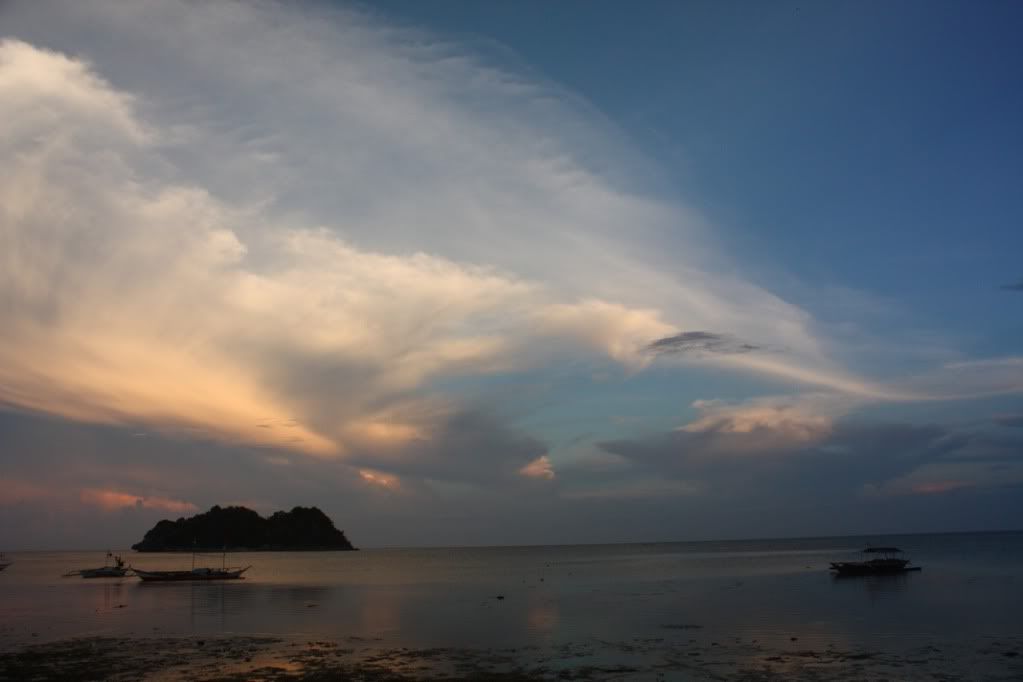
It was close to 6pm when we finally got back to Asluman. Since the waters have already receded, the boat could not drop us off at the shore. We had to wade through shallow water a foot deep before we could get to dry land.
Once we got there, we didn’t walk towards the resort right away. We spent some time sitting on the sand, taking pictures of the dusk as well as the surroundings. We were also congratulating ourselves having an excellent day-long adventure. No doubt, we were all planning to come back sometime in the future.
I feel there’s much more to see in the Gigantes that a 2-day itinerary would be a great idea. For one, we only used Gigantes Norte as a homebase and entry/exit point. But I heard that there are also caves near Asluman where actual prehispanic artifacts were found. It’s definitely worth exploring. In addition, there were also a number of other islands I’ve read in other people’s itineraries that we haven’t had the chance to visit.

We started walking back to the resort in the fading daylight. Same as when we first arrived here, everyone was outside, either doing chores or just hanging out. What I found odd was that while Asluman had a lot of dogs, not a single one was hostile at all. In fact, it was quite the opposite. The dogs were gentle and it seemed as if they always had a dazed expression.

Funny cigarette brand.
For example, the resort has a heavy-built dog named “Bantay” (yes, how stereotypical), who technically should look scary, but is so gentle that you’d want to give it a hug. (We didn’t. There’s still the matter of odor and manges to be considered.) Unlike the other island dogs though, Bantay is very friendly and is genuinely happy to see the resort’s guests when they return. When we got back, Bantay was wagging its heavy tail so hard out of happiness that its whole body was shaking.
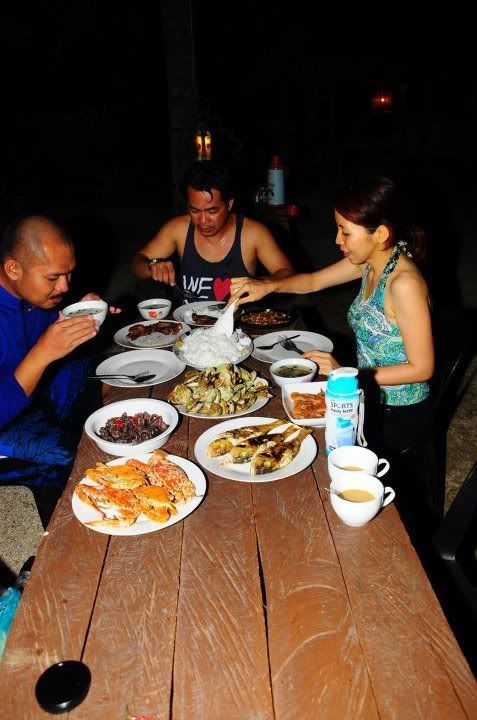
Dinner was already being prepared when we arrived, but the first thing we all wanted to do was take a shower. Our clothes and skin were so encrusted with dried seawater that it felt uncomfortably sticky. But when the food was set before us, all feelings of stickiness temporarily disappeared and we eagerly sat at our places around the table to savor and enjoy this dinner that is every bit a feast as the previous night was. Once again, there were a lot of scallops to be had. Whatever we could not finish eating, we “reserved” as pulutan later, when we’d be having beer.
Aside from the food that the resort prepared, we also brought some fruits from Estancia soe of which we haven’t eaten yet. We were pleased to find out that they refrigerated the watermelons and it was really cold when it was brought to us. Richie and I gorged on a few slices after dinner. I just hope all this mixing of food would not have an adverse effect when I drink beer afterwards.
But first, I had to take a shower. Not even the bliss of just having had an excellent dinner could hold back the icky feeling anymore and I promptly took my turn in the shower room after Gracey. I remember spending a lot of time pre-rinsing to get rid of all the salt first because the soap just won’t lather. When it was finally time to drink, I found that I got tipsy so easily. It might be because I was already so tired and/or so full, that it only took a few gulps of Red Horse to push me towards sleepiness.
I reluctantly left the drinking table after just one bottle of Red Horse (and dozens of scallops). I was so sleepy that I could hardly open my eyes anymore while brushing my teeth. Gracey followed soon after, but Richie was made of sterner stuff. He and Joel drank until the wee hours of the morning.
What a great day this was. Good night.
= = = = = = = = = = = = = = = = = = = =
This entry is part of the Iloilo & Guimaras series dated March 23-27, 2012:
1. Looking for Travel Buddies
2. Preview: Tangke Saltwater Lagoon
3. Las Islas de Gigantes (prologue)
4. Las Islas de Gigantes (morning)
5. Las Islas de Gigantes (afternoon)
6. Why are they called the “Gigantes Islands” anyway?
7. Gigantes Islands Sample Itinerary & Budget Estimate
8. Gigantes Islands Travel Guide
9. Las Islas de Gigantes (epilogue)
10. Back to the mainland, back to the city
11. Day Trip to Guimaras (morning)
12. Day Trip to Guimaras (afternoon)

Hi sir! Your blogs are great! We’re planning to go here next week. Is it possible if it would be a 2day itinerary instead of 3? Im not fond of spelunking, so we’re planning to island hop just around the north, and head back to the resort so we could take the 2pm boat ride back to estancia? Is it possible?
Hi Ghie, that would be possible IF there were a 2pm boat ride back to Estancia. As far as I know, there is none. There are other things to do aside from spelunking, so you might as well stay another night and discover more islands, perhaps. 🙂
Pingback: Discover Interesting Places In Iloilo Part 7 | Travel to the Philippines
Pingback: Pawikan Cave in Iloilo | Travel to the Philippines